Cancún, Quintana Roo — Mexico’s National Weather Service, Servicio Meteorológico Nacional (SMN), has released its official forecast for the 2026 Atlantic hurricane season, projecting between 11 and 15 named storms—figures that place the Mexican Caribbean firmly in the conversation once again as the season approaches.
The outlook was presented during the National Civil Protection Meeting in Veracruz, where federal and state officials emphasized a familiar but important message: even in a “moderate” season, the risk to coastal regions like Quintana Roo remains significant.
A Season Defined by Contrasts
SMN Director Fabián Vázquez Romaña pointed to a key climate driver shaping this year’s forecast—a transition toward El Niño conditions.
El Niño typically shifts hurricane activity toward the Pacific while suppressing formation in the Caribbean due to stronger trade winds and increased wind shear. On paper, that suggests fewer storms forming locally.
But the situation is more complicated.
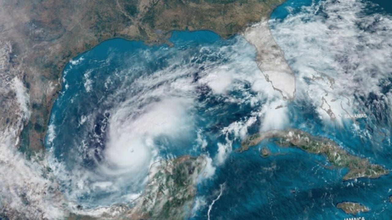
Sea surface temperatures across the Atlantic and Gulf of Mexico remain unusually warm, continuing a trend seen over the past several years. Warm water is the primary fuel for hurricanes, and even with less favorable wind conditions in parts of the Caribbean, it creates the potential for storms that do form to intensify quickly.
“We could have a transition to a warm base… known as El Niño,” Vázquez Romaña explained. “If the Pacific Ocean is warmer, we would have more energy for more hurricanes to form there, but that causes trade winds in the Caribbean to be very intense, making it hard for cyclones to form in the Caribbean. However, the Atlantic as a whole has shown a positive temperature anomaly; it has been very warm in recent years, so cyclones could indeed form there.”
What the Numbers Say
The SMN’s forecast for the Atlantic basin breaks down as follows:
- 11 to 15 tropical cyclones
- 7 to 8 tropical storms
- 3 to 5 hurricanes (Category 1 or 2)
- 1 to 2 major hurricanes (Category 3, 4, or 5)
The official season runs from June 1 through November 30, with peak activity typically occurring in September—historically the most active month for storm development in the region.
Why Quintana Roo Still Needs to Pay Attention
For residents and expats in the Riviera Maya, the takeaway is straightforward. Lower storm counts do not necessarily mean lower risk.
Storm tracks are unpredictable, and the region has seen firsthand how a single system can cause widespread disruption. From flooding and power outages to airport closures and evacuation orders, the impact of one direct hit can outweigh the statistics of an entire season.
Authorities stressed that preparedness—not projections—is what ultimately matters.
“This is the numbers game; we must be prepared. We really only need one; one is enough to get us into trouble,” Vázquez Romaña said. “That’s the message: the one that hits us is the one we have to be well prepared for.”
Names to Watch This Season
As always, the World Meteorological Organization rotates a predetermined list of storm names. For 2026 in the Atlantic, those include:
Arthur, Bertha, Cristobal, Dolly, Edouard, Fay, Gonzalo, Hanna, Isaias, Josephine, Kyle, Leah, Marco, Nana, Omar, Paulette, Rene, Sally, Teddy, Vicky, and Wilfred.
The Bottom Line
While 2026 may not be shaping up as an extreme year in terms of storm count, the combination of warm waters and shifting climate patterns keeps the Mexican Caribbean in a familiar position: watchful, exposed, and dependent on preparation.
For anyone living along the coast, hurricane season isn’t about how many storms form—it’s about where they go.