Mexico City — Mexico City is sinking nearly 25 centimeters (10 inches) per year, according to new satellite images released this week by NASA, making it one of the fastest-sinking metropolises in the world.
Spanning 7,800 square kilometers (3,000 square miles) and home to about 22 million people, the Mexican capital and surrounding cities were built on the bed of an ancient lake. Many streets in the city center were once canals, a tradition still preserved in outlying rural areas.
Intensive groundwater extraction and urban development have drastically depleted the aquifer, causing Mexico City to sink for more than a century. This has left many historic monuments and buildings — such as the Metropolitan Cathedral, whose construction began in 1573 — visibly tilted. The shrinking aquifer has also contributed to a chronic water crisis expected to worsen.
“It damages critical infrastructure in Mexico City, such as the metro, drainage system, water supply, drinking water system, housing, and streets,” said Enrique Cabral, a geophysics researcher at the National Autonomous University of Mexico. “It is a very serious problem.”
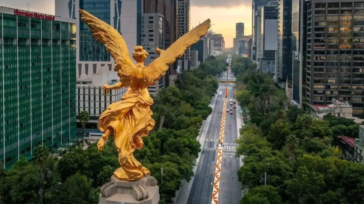
In some areas, the sinking occurs at an average rate of 2 centimeters (0.78 inches) per month, according to the NASA report, including at the main airport and the iconic Angel of Independence monument. That adds up to about 24 centimeters (9.5 inches) annually. Cabral noted that in less than a century, the ground has dropped more than 12 meters (39 feet).
“We have one of the fastest land subsidence rates in the world,” he said.
NASA’s estimates are based on measurements taken between October 2025 and January 2026 by the powerful NISAR satellite, a joint initiative between NASA and the Indian Space Research Organisation that can track real-time changes on Earth’s surface.
NISAR scientist Paul Rosen said that by capturing details from space, the project is also “telling us something about what is really happening beneath the surface.”
“Basically, it’s about documenting all these changes within a city,” Rosen said. “You can appreciate the full magnitude of the problem.”
Over time, the team hopes to zoom in on specific areas and eventually obtain building-by-building measurements. More broadly, researchers aim to apply this technology worldwide to track natural disasters, fault line changes, climate change effects in regions like Antarctica, and more. Rosen said it could strengthen early warning systems, allowing scientists to alert governments about evacuations during volcanic eruptions.
For Mexico City, Cabral said this technology represents a major advance in studying land subsidence and mitigating its worst effects. For decades, the government largely ignored the problem, except for stabilizing foundations of monuments like the cathedral. But after recent flare-ups of the water crisis, authorities have begun funding more research.
NISAR satellite images and accompanying data will be key for scientists and officials planning how to address the issue.
“To mitigate the situation in the long term,” Cabral said, “the first step is simply to understand it.”