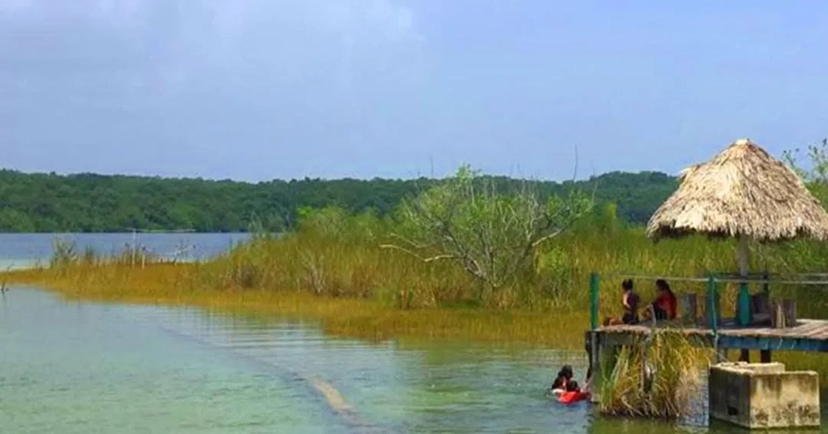
José María Morelos, Quintana Roo — Researchers are investigating a possible underground fracture that could be affecting the Chichankanab lagoon in this municipality in Quintana Roo’s Maya zone, a project led by cave explorer and diving expert Robbie Schmittner.
The team has been monitoring sites across the Yucatan Peninsula, including the communities of Dziuché and San Marcos in this municipality, to determine whether a deep geological crack passes beneath the area.
A Crack Traced From Chicxulub
Investigators believe the suspected fissure begins at the Ring of Cenotes near Chicxulub, crosses the Sierra de Ticul and continues beneath the peninsula. They describe it as one of a network of six major fractures that allow groundwater to move through the region, and they are trying to establish whether it reaches the Maya zone of Quintana Roo.
“The mother of all the main fractures is the Ring of Cenotes. It was created — and very clearly confirmed — by the Chicxulub meteorite impact there in the area,” Schmittner said in an interview. “It is a round fracture; half of it lies beneath the water of the Gulf of Mexico and the other half is underground. That round fracture was made by the impact.”
The work aims to test the hypothesis that the Chichankanab lagoon is connected to the sea.
“That fracture comes very clearly from the south of the Ring of Cenotes, very clearly, running from there to the Chichankanab lagoon area,” Schmittner said. “There are other indicators showing a connection between the sea and the lagoon, because there are stromatolites inside the lagoon.”
He noted that stromatolites require high salinity levels, which is why researchers suspect a link to the sea.
Mapping How Water Moves Underground
The project is also intended to help scientists understand how water circulates beneath the peninsula, what connections exist between geological formations, and how far contaminants that enter local waterways can travel.
Researchers believe the roughly 2,000 kilometers of underground rivers documented in Quintana Roo and the Yucatan Peninsula may be only part of a much larger network that remains hidden.
Schmittner said Quintana Roo holds other subjects worth studying, including stromatolites and the discovery of a live hammerhead shark in the Chichankanab lagoon.
More Environment
- Bull Shark Spotted Near Swimmers at Playa del Carmen’s Playa 72
- Mexico Confirms H5N1 Bird Flu at Yucatán Egg Farm, 862 Birds Dead
- Firms Pursue Battery Storage Plant in Playa del Carmen Despite Semarnat Rejection
- Aguakan Invests 7 Million Pesos in New Sewer Line in Puerto Morelos
- Aquaponics Arrives in Quintana Roo With First Agrotourism Farm in the Riviera Maya
More Quintana Roo
- Quintana Roo Tourism Activity Slips 0.8% Despite Cruise Boom
- Mexican Caribbean Forecasts Winter Tourism Surge as Flight Seats Rise 24 Percent
- Quintana Roo Reopens Pink Conch Season as Illegal Fishing Persists
- Quintana Roo Congress Weighs Bill to Regulate AI Use in State and Municipal Government
- Cancún Leads Quintana Roo Will Drive as 2,104 Testaments Are Filed