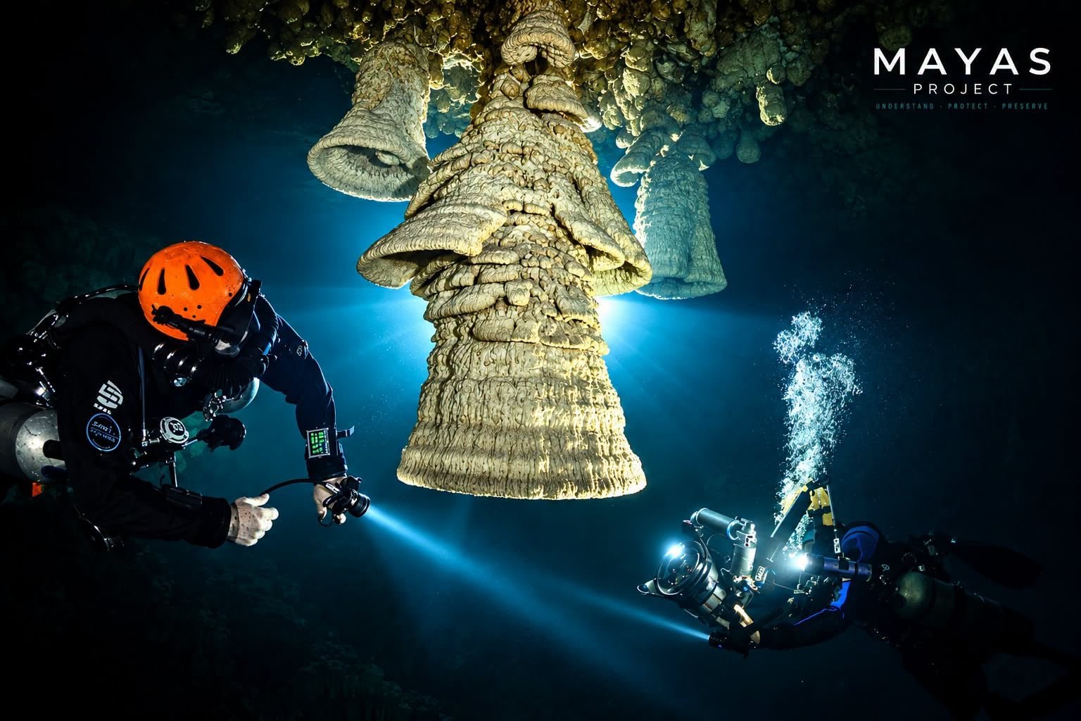
Tulum, Quintana Roo — An international team of scientists backed by Mexico’s National Commission of Protected Natural Areas (Conanp) has launched Project Mayas, a research effort to trace how groundwater moves beneath the Yucatan Peninsula and to map the geological structures that shape one of the largest karst aquifer systems on Earth.
Led by Robbie Schmittner, a cave-diving explorer and specialist, the project proposes a new interpretation of how the subterranean water system works. It suggests that vast flooded cave networks such as Ox Bel Ha and Sac Actun may be only secondary formations created by hydraulic processes of far greater scale.
Six Geological Structures Under Study
The research focuses on six major geological structures: the Chicxulub cenote ring and the Sierrita de Ticul in Yucatan, and the Holbox fracture zone and the Akumal structural region in Quintana Roo. Their possible interconnection could explain how water travels across large stretches of the peninsula and southern Mexico.
One central hypothesis holds that marine currents in the Yucatan Channel may influence regional groundwater circulation, though that possibility still has to be confirmed through measurements and hydrogeological studies.
Drones, Water Chemistry and Biological Sampling
To test their ideas, specialists are conducting underwater exploration, geophysical surveys using drones, analysis of water chemistry, current measurements and biological sampling. Participants include UNAM, GeoSphere Austria and Friedrich Schiller University of Jena in Germany, as well as Mexican agencies INAH and Conanp.
The explorations have also produced scientifically significant finds, including human remains dating to the last Ice Age and a blind cave fish that may represent a species new to science.
A Five-Year Research Program
The project aims to build a research program of at least five years that would deepen understanding of the aquifer’s connections, identify zones vulnerable to contamination and generate knowledge to protect cenotes, wetlands, mangroves, coastal lagoons and reefs.
The work is especially relevant for Quintana Roo, where urban growth, real-estate pressure and inadequate wastewater treatment threaten the quality of groundwater that communities, local industries and ecosystems depend on.
More Environment
- Quintana Roo Seeks UN Help Against Sargassum After Record Year
- Playa del Carmen’s Water Pollution Rules Exist but Go Unenforced, Activist Says
- Conapesca Has Issued No New Commercial Fishing Permits in Playa del Carmen for 17 Years
- Environmentalists Denounce Road and Gate Built in Cozumel Mangrove Tied to Royal Caribbean Project
- Mincho, the Dolphin Whose Injury Helped Change Mexican Law, Dies in Cancún
More Quintana Roo
- Mexican Caribbean Hotel Occupancy Rebounds to 62.1% at Start of November
- Quintana Roo Nautical Association Pursues Maritime Alliance With Belize
- Quintana Roo Bets on Diving, Gastronomy and Air Connectivity to Revive Tourism Growth in 2027
- Quintana Roo Women’s Secretariat Reports 60% Rise in Services
- Quintana Roo Cyber Police Take Down 10 Pages and Groups, 286 Profiles Over Online Scams