
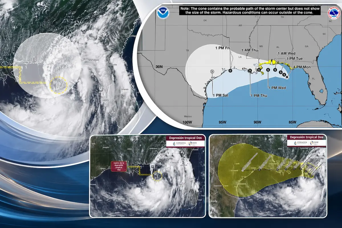
Mérida, Yucatán — Tropical Depression Two continues moving over the northeastern Gulf of Mexico, where conditions remain favorable for strengthening in the coming hours, but Mexican meteorological authorities have ruled out any danger to the country due to its distance and trajectory.
According to the latest report from the National Meteorological Service (SMN) and the National Water Commission (Conagua), issued at 3:00 p.m. Monday, the system’s center was located 165 kilometers south of Panama City, Florida, and 800 kilometers north of Cabo Catoche, Quintana Roo.
The depression has maximum sustained winds of 55 kilometers per hour, gusts of 75 km/h, and is moving northwest at 6 km/h, producing no direct effects on Mexican territory.
Mexican authorities said that due to its location and expected evolution, it poses no risk to the coasts of Quintana Roo, Yucatán, or Campeche, though they recommended staying alert to information from official channels.
The U.S. National Hurricane Center (NHC) maintains a forecast of gradual strengthening. Trajectory models indicate the depression could reach tropical storm strength before approaching the northern Gulf coast, with a possible landfall between Louisiana and eastern Texas by the end of the week.
The forecast cone also shows that the greatest expected impacts would be on the U.S. coastline, where tropical storm watches have already been issued in several coastal sectors.
Although the trajectory keeps the system away from the Yucatan Peninsula, specialists noted that the Atlantic hurricane season remains active and new systems could develop in the coming weeks. They urged the public to follow only information from Conagua, the National Meteorological Service, and Civil Protection to avoid rumors or false information.
More Environment
- Greenpeace Finds Contamination at 17 Yucatán Wells and Cenotes as Maya Communities Demand Action
- Quintana Roo Tops 152,000 Metric Tons of Sargassum as Playa del Carmen and Cancún Lead
- Profepa Shuts Down Los Rápidos Swimming Spot in Xul-Ha Over Missing Environmental Permit
- Court Gives Profepa 72 Hours to Clarify Tren Maya Closure Order
- National Geographic Names Maya Ka’an Among Top Destinations to Visit in 2027
More Quintana Roo
- Quintana Roo Beaches Lose Up to 14 Meters of Sand a Year as Restoration Plan Advances
- Quintana Roo Youth Sailors Join Mexico’s Team for Optimist Championship in Uruguay
- Mara Lezama Hands Out 100 Sewing Machines in Chetumal to Boost Women’s Self-Employment
- Tourism Slump Forces 35% of Skål México Businesses to Borrow to Cover Payroll
- Crystal Meth Addiction Surges in Quintana Roo, Fuels Nearly 90% of Homicides