
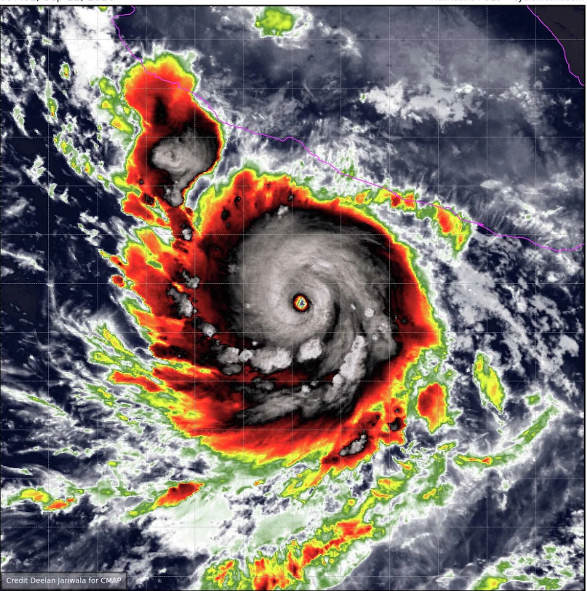
Hurricane Polo grew into a Category 5 storm Tuesday in the eastern Pacific off southwestern Mexico and was forecast to bring heavy rain to southwestern Mexico but remain offshore.
It had maximum sustained winds of 160 mph (257 kph), the U.S. National Hurricane Center in Miami said.
Polo went from a 40 mph tropical storm to a 160 mph Category 5 monster in just 36 hours, which would be the fastest such development recorded in the eastern Pacific.
Polo was moving east at 6 mph (10 kph) and was forecast to sharply turn northwest and west-northwest. On that path, Polo would skirt the Mexican coast for a few days without directly making landfall.
A tropical storm watch was issued for part of the coast south of Manzanillo in Colima state to Tecpan de Galeana in Guerrero state, meaning tropical storm conditions were possible in the area within two days. Polo was centered about 360 miles (579 kilometers) south-southeast of Manzanillo.
Heavy rain with the potential for flooding and landslides was forecast for coastal Guerrero and Michoacán states through Thursday. Smaller amounts of rain were possible in coastal portions of Oaxaca, Colima and Jalisco states.
Category 5 is the highest level on the Saffir-Simpson scale, reflecting that the storm’s maximum sustained winds exceed 157 mph (253 kph).
Farther west in the Pacific Ocean, Tropical Storm Odalys was far from land but expected to become a hurricane by midweek. Odalys had maximum sustained winds of 65 mph (105 kph) on Tuesday.
More Environment
- Cozumel Launches Rabies Vaccination Drive With 3,000 Free Doses for Pets
- Sargassum Collection in Quintana Roo Tops 133,000 Tons, Setting New Record
- Isla Mujeres Collects Over 160,000 Tons of Waste in Five Years
- Tulum Beach Cleanup Pulls 32 Kilos of Marine Debris From Playa del Pueblo
- Puerto Morelos Approves Funds to Protect Beaches and Strengthen Sargassum Response