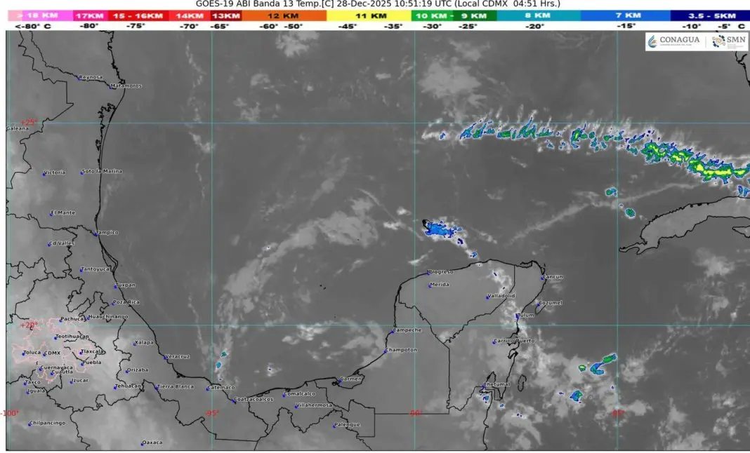
Cancún, QR. – The frontal system number 24 dissipated during the morning of Saturday over the north of the country; however, by the afternoon-evening a new Cold Front 25 will enter, driven by an arctic air mass that will mainly affect the north and northeast of Mexico, with a marked drop in temperatures, strong to very strong winds, rains and showers, as well as the possible fall of snow or sleet in areas of Chihuahua.
In contrast, in the southeast of the country, conditions of atmospheric instability will persist. A trough of low pressure and a cyclonic circulation in the middle and upper levels of the atmosphere will favor rains and showers in the east, south and southeast of the national territory, including the Yucatán Peninsula, with isolated heavy rains in Chiapas and Quintana Roo.
Cold Front 25 Will Affect Quintana Roo
For Quintana Roo, the arrival of Cold Front 25, the presence of a trough of low pressure, an upper-level trough over the Yucatán Peninsula, and the inflow of moisture from the Caribbean Sea will maintain partly cloudy to cloudy skies during the course of the day. Intervals of showers with isolated heavy rains are forecast, with estimated accumulations of 25 to 50 millimeters, hot conditions during the day and mild to cool at dawn.
The wind will blow from the east with gusts of up to 50 kilometers per hour, mainly in coastal areas. In addition, the presence of fog banks is reported in rural areas, urban areas and highway sections, which could persist during the next few hours, reducing visibility.
During the morning, between 07:00 and 10:00 hours, isolated rains and showers were forecast in the municipalities of Chetumal and Bacalar, as well as wind of 10 to 20 kilometers per hour with gusts of 30 to 50 kilometers per hour due to the arrival of Cold Front 25.
Forecast by Municipality
- Cancún: Partly cloudy skies, isolated rains and showers. East wind of 15 to 25 km/h with stronger gusts. Maximum temperature of 30 to 32 degrees Celsius; minimum of 21 to 23. Thermal sensation of up to 34 degrees.
- Lázaro Cárdenas: Similar conditions, with maximum temperatures of 30 to 32 degrees and minimums of 21 to 23.
- Isla Mujeres: Partly cloudy skies and isolated showers. Maximum temperatures of 30 to 32 degrees.
- Cozumel: Partly cloudy skies, no significant rains. East wind of 18 to 27 km/h. Maximum temperatures of 26 to 28 degrees.
- Playa del Carmen: Rains with intervals of showers. Maximum temperature of 29 to 31 degrees.
- Tulum: Mostly cloudy skies, showers and possible electrical activity. Maximum temperatures of 29 to 31 degrees.
- José María Morelos: Rains with intervals of showers and hot conditions. Maximum temperatures of 30 to 32 degrees.
- Felipe Carrillo Puerto: Showers with possible electrical activity. Minimum temperature of 16 to 18 degrees.
- Chetumal: Rains with intervals of showers and electrical activity. Maximum temperatures of 29 to 31 degrees.
- Puerto Morelos: Partly cloudy skies, isolated rains and showers. Maximum temperature of 29 to 31 degrees.
- Bacalar: Mostly cloudy skies, rains with intervals of showers and electrical activity. Maximum temperatures of 29 to 31 degrees.
The authorities recommend that the population stay informed through meteorological bulletins, take extreme precautions due to wind gusts that could cause the fall of trees or signs that will be caused by Cold Front 25, and drive carefully in the presence of fog and rain.
Discover more from Riviera Maya News & Events
Subscribe to get the latest posts sent to your email.