
Cancún, Quintana Roo — Quintana Roo will experience partly cloudy skies with isolated showers on Wednesday, with temperatures rising to very hot conditions in the afternoon after a mild morning.
The forecast also calls for east and southeast winds of 20 to 30 km/h, with gusts that could reach between 40 and 60 km/h on the Yucatan Peninsula, conditions that will be most noticeable in coastal areas.
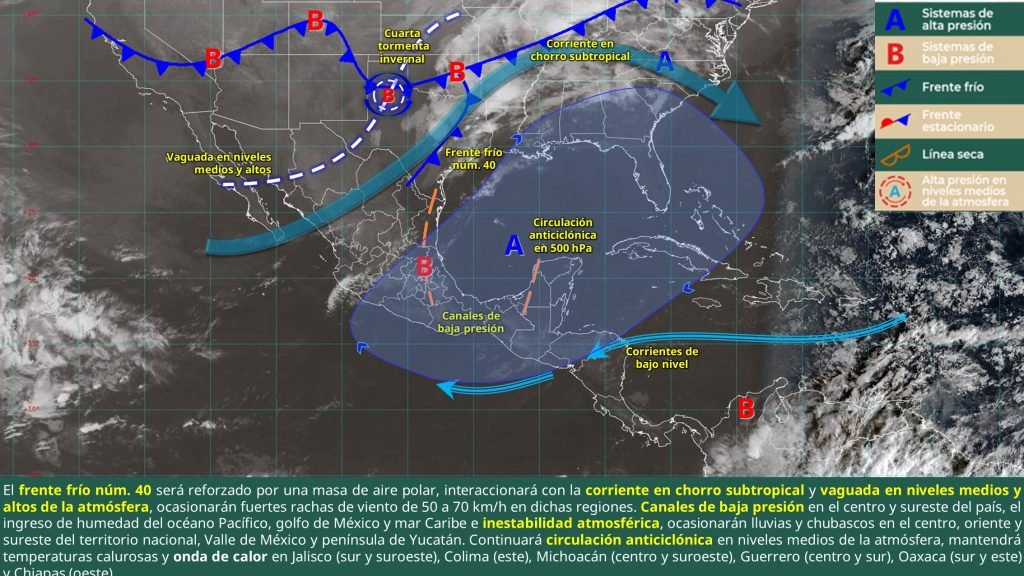
Nationally, cold front number 40 is advancing over northern and northeastern Mexico, reinforced by a polar air mass. This system will bring strong winds and isolated showers to states including Tamaulipas and San Luis Potosí.
Additionally, low-pressure channels and moisture from the Pacific Ocean, Gulf of Mexico, and Caribbean Sea will generate showers and thunderstorms with electrical discharges in central, eastern, and southeastern regions of the country.
Meteorological authorities predict that starting early Thursday, a very strong “Norte” weather event will develop in the Gulf of Mexico and gradually extend its effects toward the southeast, including the Yucatan Peninsula.
More Lifestyle
- Playa Aventuras DIF Records Historic Sea Turtle Nesting Season
- Puerto Morelos Expands Civil Registry Services With Mobile Brigades
- Electric Vehicles to Dominate Mexico Car Sales, Hitting 66% by 2040
- Puenteando Festival Returns to Cancún’s Nichupté Bridge for Third Edition
- Quintana Roo Reports 33 New Dengue Cases, Reinforces Prevention Efforts
More Quintana Roo
- Quintana Roo Transport Union Prepares Bid for 20% Fare Increase
- Quintana Roo Business Group Urges Taxpayers to Prepare for 2027 Fiscal Changes
- Toni Chaves Reelected to Lead Riviera Maya Hotel Association Through 2028
- Quintana Roo Judicial Branch Certifies More Than 70 Mediation Facilitators
- Tropical Wave 40 Lashes Quintana Roo, Toppling CFE Pole and Cutting Power in Cancún
