
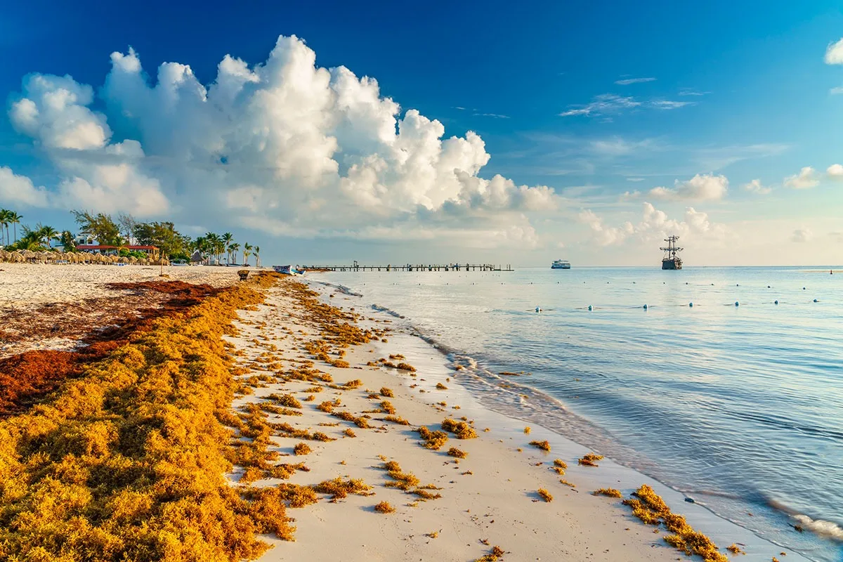
Cancún, Quintana Roo — Sargassum levels have dropped across much of northern Quintana Roo, but several stretches in the south are still buried under heavy seaweed, according to a monitoring survey released this month.
The Nov. 6 report, produced by the Kinich Ka’an environmental monitoring program with participation from the state Secretariat of Ecology and Environment (SEMA), found 97 beaches with low sargassum presence and five completely free of the seaweed out of 140 sites surveyed.
That amounts to 102 beaches in favorable condition. The same survey identified 22 sites with moderate presence, 13 with heavy accumulation and three with excessive levels.
North and South Diverge Sharply
The gap between regions is the survey’s most striking finding.
In the north, 89 beaches reported low sargassum levels and three had none at all. No northern site recorded excessive accumulation.
The south told a different story: only eight beaches reported low levels and two were clear, while Xcalak, Canal de Zaragoza and Bacalar Chico all registered excessive conditions.
The results show the seaweed does not affect every tourist destination on the Mexican Caribbean coast the same way.
Satellites Show the Seaweed Keeps Coming
Even where beaches look favorable, satellite data confirm the phenomenon remains active.
The Observatorio Ciudadano del Sargazo reported that the seaweed’s detected surface area in the region grew 15.2% between Nov. 6 and Nov. 11. Its Nov. 11 update listed 41 beaches free of sargassum and 15 with low presence — but also 42 with excessive accumulation.
Separately, the National Commission for the Knowledge and Use of Biodiversity (CONABIO), through its SATsum system, recorded roughly 3,997 metric tons of sargassum in Mexico’s Caribbean exclusive economic zone on Nov. 12.
That figure was 10.1% higher than the previous day’s reading. The volume reflects biomass detected at sea and does not mean all of it will wash ashore.
What It Means for Visitors
November’s conditions open up options for beachgoers, particularly in northern Quintana Roo, but they do not guarantee that the entire coastline is clear.
Monitoring is handled by the state Secretariat of Ecology and Environment, the federal Secretariat of Environment and Natural Resources, and CONABIO, which uses satellite imagery to track the seaweed’s path.
Tourists and residents should check updated reports for the specific destination they plan to visit before setting out.
The drop in beachings at some sites offers relief for tourism and recreation, but sargassum remains unpredictable and requires monitoring year-round, officials said.
More Environment
- Fonatur Prepares Two-Stage, $108 Million Sargassum Plan for 2027
- Secrets Marina Seeks Semarnat Approval for 7,933-Square-Meter Beach Club in Puerto Morelos
- Uxuxubi Seeks Tourism Distinction, Asks for Water Tests at Its Cenotes
- Quintana Roo Launches Green Distinctive Certification for Tourism Businesses
- Semarnat Weighs Clearing Tulum Jungle for 158-Space Parking Lot
More Quintana Roo
- Buen Fin 2026 in Quintana Roo: Property Tax Fines Waived, but No Driver’s License Discounts
- Quintana Roo Registry Lists 193 Irregular Real Estate Developments
- Researchers Unveil 3D Replica of Ice Age Bear Skull Found in Quintana Roo Cave
- Aguakan Details Chlorine Gas Controls in Quintana Roo Water Treatment
- Quintana Roo Hands Out First Rural Sector Merit Awards to Three Workers