
Mérida, Yucatán — A low-pressure system in the Gulf of Mexico is being closely watched by weather authorities as it shows signs of strengthening into a tropical depression in the coming days.
Yucatán’s Civil Protection agency, known as Procivy, said it is keeping constant watch on the system, with forecast models indicating it could reach tropical depression status by the middle or end of this week.
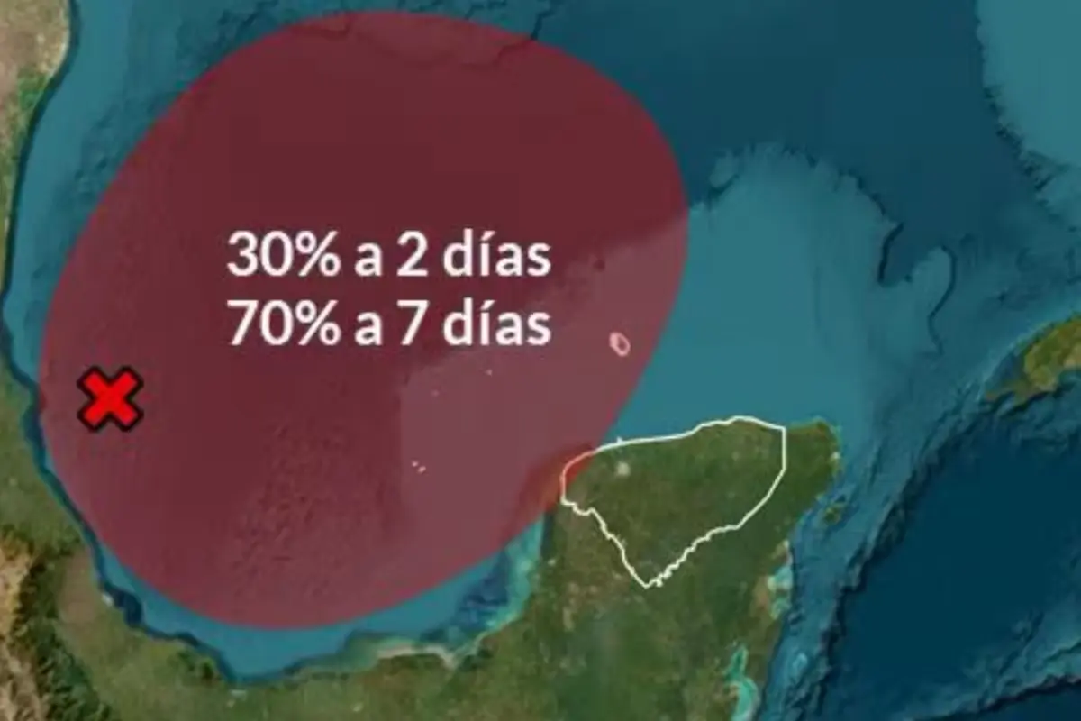
The National Meteorological Service, part of the water agency Conagua, reported that the low-pressure area has a 30 percent chance of cyclonic development within 48 hours and a 70 percent chance over the next seven days.
The system is located about 105 kilometers (65 miles) east of Cabo Rojo, Veracruz, and is currently moving eastward. Forecasts suggest it could continue in that direction before turning north.
Rain and Rough Seas Expected
No tropical cyclone has been confirmed yet, but authorities are maintaining surveillance because of how the system over the Gulf of Mexico could evolve.
Procivy said that regardless of whether the system develops into a tropical depression, weather models point to stronger waves offshore and near the coast, along with rainfall of varying intensity across Yucatán.
Those conditions could occur between Wednesday, October 7, and Saturday, October 10, so residents are urged to follow official updates as the week progresses.
Safety Recommendations
Ahead of possible rain, higher waves and shifting weather, Yucatán residents are advised to take the following precautions:
- Rely only on official sources for information, mainly Procivy, the National Meteorological Service and Conagua.
- Avoid sharing unconfirmed information about an alleged cyclone’s formation or path.
- Check weather updates before heading to coastal areas or out to sea.
- Follow advisories and recommendations issued by civil protection authorities.
- In heavy rain, drive with extra caution and avoid areas prone to flooding.
- Stay alert to possible changes in the forecast over the coming days.
The system’s evolution, trajectory and intensity can still change, and meteorological information will be updated as new data is fed into forecast models. For now, authorities continue to monitor the low-pressure area and will wait to see whether it reaches tropical depression status and where it might head.
More Environment
- Yucatán Peninsula Lost 285,580 Hectares of Jungle in 4 Years
- Quintana Roo Crews Clear 70,000 Liters of Water in Bacalar and Chetumal After Heavy Rains
- Yucatan Drafts Rules for Artificial Lakes After Worker Dies of Amoeba Infection
- Quintana Roo Wins SEMARNAT Approval to Restore 33.5 Km of Beaches
- Technical Study Advances for Quintana Roo’s Grand Subterranean Rivers Reserve
More Quintana Roo
- Tropical Wave 36 Floods Northern Quintana Roo, Hits Tourism
- Cancún Airport Flight Operations Rise 4.4% at Start of October
- Canadian Tourism to Quintana Roo Grows Nearly 12% in 2026 as New Winter Routes Loom
- Quintana Roo Schools Shut Oct 30 Creating a Four Day Weekend
- Quintana Roo Lawmakers Move to Curb Political Use of Social Programs