CHETUMAL, MX — The National Hurricane Center (NHC) reported on Tuesday that an area of low pressure over the central Caribbean Sea is showing clear signs of organization and could become a tropical storm during the course of the day.
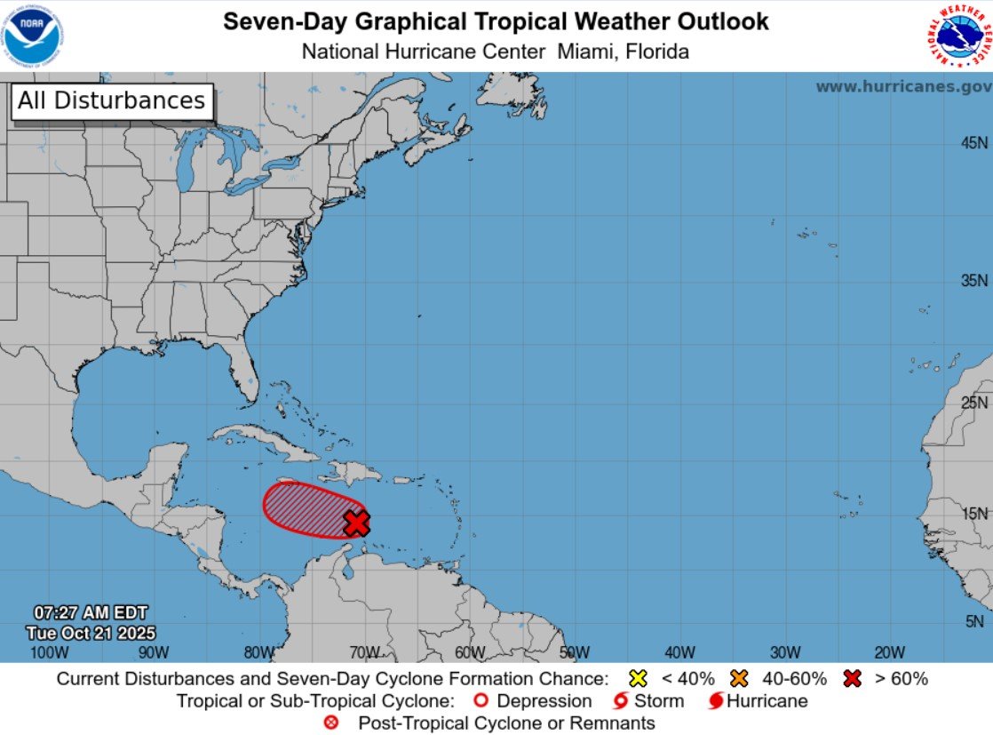
According to the 8:00 a.m. Eastern Time report, satellite imagery, radar, and surface observations indicate that the system, identified as AL98, has already developed a well-defined center and is registering sustained winds of up to 45 miles per hour (72 km/h).
The phenomenon is moving slowly over the central Caribbean Sea, and it is forecast to generate heavy rains and wind gusts over the next 24 to 48 hours over parts of the ABC Islands (Aruba, Bonaire, and Curaçao).
The NHC warned that Puerto Rico, the Dominican Republic, Haiti, Jamaica, and Cuba should monitor the development of this system, as there is a risk of flooding, intense winds, and high surf towards the end of this week.
The Air Force Hurricane Hunters have a reconnaissance mission scheduled for this Tuesday to obtain more precise information about the system's structure and intensity.
The U.S. agency highlighted that the probabilities of cyclonic development are high, at 100 percent for both 48 hours and seven days, suggesting that the system could be named a tropical storm shortly.
More Environment
- Punta Esmeralda Access Road Work Lacks Environmental Permit, Biologist Warns
- El Dorado Royale Opens First Aquaponics Agrotourism Farm in the Riviera Maya
- Semarnat Rejects 387-Home Incaribe Development on Punta Sam–Cancún Road
- Mexican Navy Removes 181 Tons of Sargassum From Quintana Roo in a Single Day
- Cancún Construction Blocks Blue Crab Migration Routes to the Sea
