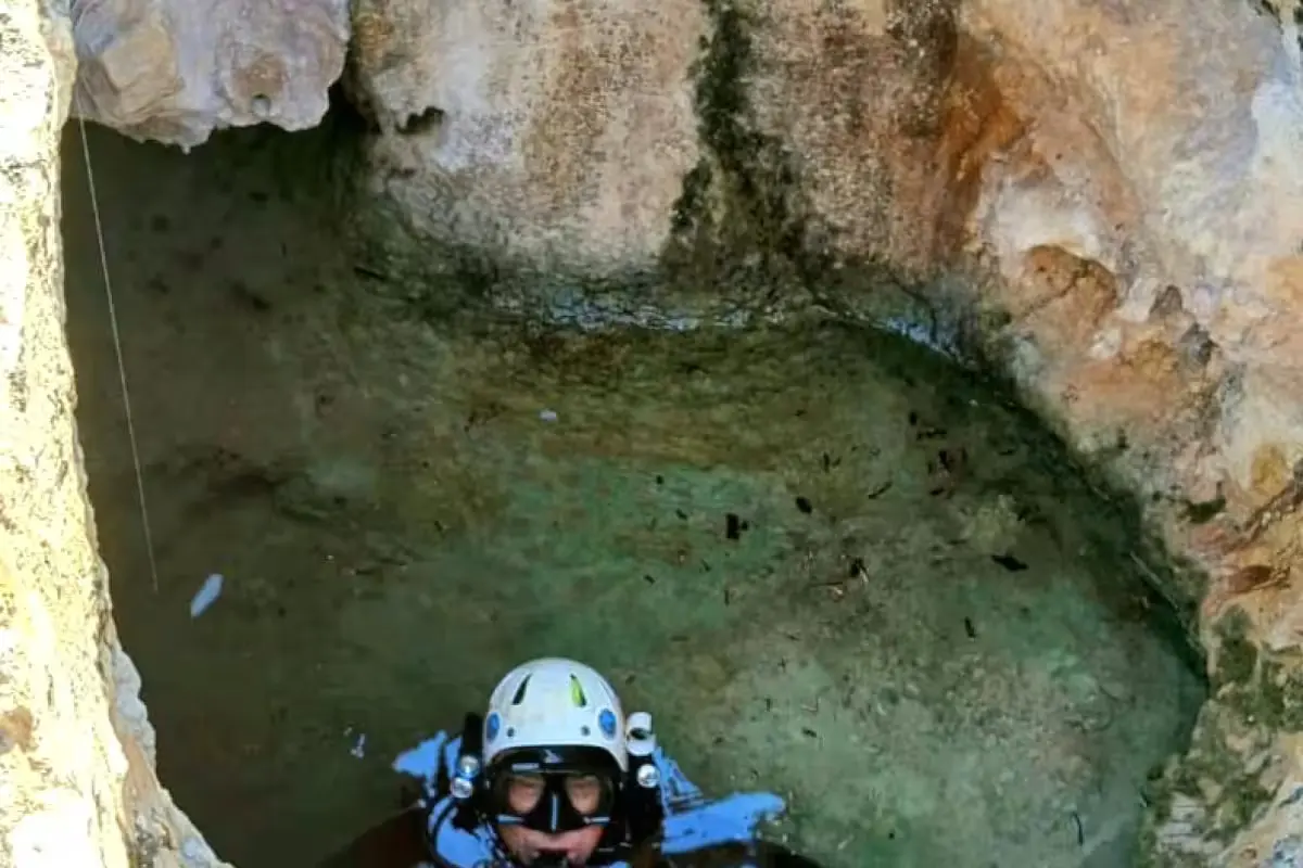
Cozumel, Quintana Roo — A team of cave specialists has located and documented a previously unrecorded underwater system south of Cozumel. The site, named Cueva Popotitos, holds mostly fresh water, reaches about 10 meters in depth so far, and contains galleries that continue southward along with numerous mineral formations, according to speleologist Germán Yáñez Mendoza.
Yáñez said the name comes from the hundreds of calcareous structures known as “soda straws” — thin, straw-like formations that grow on the walls and ceilings of caverns.
How the Cave Was Found
The speleologist said he carried out the work alongside Carolina Ceballos, and that the site was pinpointed after the team received information about a collapsed entrance, beneath which lay a body of water. An initial inspection established the conditions for entering, and the team later descended with diving gear to document the site and produce a first topographical survey.
The record compiled so far is preliminary, because some galleries continue to the south and other sections remain unexplored. “The cave continues to the south, and we still don’t know how far the system extends,” Yáñez said.
Fresh Water and a Possible Link to Laguna Colombia
During the traverse, the divers identified water that was mainly fresh and did not reach a saltwater zone in the stretch documented to date. They also observed various speleothems, including stalactites, stalagmites and columns — mineral formations produced by water-related processes inside caverns.
The location and direction of the galleries raised the possibility of a connection with other underground systems on the island, though for now that remains only a hypothesis. Among the options mentioned is a possible link to Laguna Colombia.
“The possibility exists, but it cannot be confirmed until we physically find the connection and have evidence that allows us to establish that it is the same system,” Yáñez said.
Water Samples and a Narrow Descent
The work also included water sampling with the participation of researchers from the Universidad Autónoma de Quintana Roo, coordinated by Dr. Adrián Cervantes with support from students. The analyses will reveal characteristics of the water body that cannot be determined by observation alone during a dive.
“The samples will help us better understand the water conditions and will provide information for understanding the characteristics of the underground system,” Yáñez said.
Because some sections are so tight, the divers entered one at a time and used a safety line. The procedure allowed them to move through the accessible galleries and establish the first reference points for the map.
More Environment
- Mexican Army Nears Completion of 16-Kilometer Jungle Road Over Tulum’s Sac Actún Cave System
- Akumal Halts Turtle Swim Tours Through September
- Mexico Assigns $110 Million Navy Budget to Fight Sargassum in Quintana Roo
- Mérida Opens First Green Corridor to Fight Climate Change
- El Niño Keeps Atlantic Hurricane-Free, Setting Record for Latest First Storm in Decades
More Cozumel
- Leonardo Aguilar to Headline Free Cozumel Concert for Grito de Independencia 2026
- Armed Men Try to Abduct Woman on Cozumel; She Escapes on Her Motorcycle
- Cozumel Opens New Sustainable Tourism Trail in Island’s South
- Quintana Roo Mayors Tout Results as Residents Decry Persistent Gaps
- Search Ends, but Questions Mount After Fatal Puerto Aventuras Jet Ski Trip