Cancún, Quintana Roo — A weather phenomenon known as a ‘Surada’ is bringing strong winds to the coast of Quintana Roo, with gusts reaching between 40 and 60 kilometers per hour. The winds are expected to diminish in intensity as the afternoon progresses.
The state is experiencing mostly stable conditions under the influence of an anticyclonic circulation in the mid-levels of the atmosphere. Skies will remain partly cloudy to clear, with no rain expected. The daytime will be hot, with a high thermal sensation, especially in urban and coastal areas, typical of the dry season in the Mexican Caribbean.
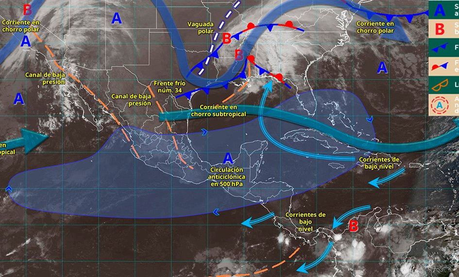
Nationally, Cold Front No. 34 and a polar trough are moving over the northern Gulf of Mexico and are no longer affecting the country. However, the associated cold air mass is still causing significant effects in several regions.
On the coasts of Veracruz, as well as in the Isthmus and Gulf of Tehuantepec in Oaxaca and Chiapas, gusts of 60 to 80 kilometers per hour are expected. In Tamaulipas, winds will reach speeds of 40 to 60 kilometers per hour, accompanied by cooler temperatures in the north, northeast, east, and center of the country.
Additionally, moisture from the Pacific and a low-pressure channel will cause showers in Puebla, Veracruz, Oaxaca, and Chiapas. Isolated rains with fog banks are also forecast for the central region, Tabasco, and San Luis Potosí.
Meanwhile, an anticyclone is maintaining a hot environment in the afternoons in the south, southeast, and the Yucatan Peninsula. In the rest of the country, cold to cool conditions will continue during mornings and nights, with a low probability of precipitation.
Discover more from Riviera Maya News & Events
Subscribe to get the latest posts sent to your email.