Tulum, Quintana Roo — The Sian Ka’an biosphere reserve appears among the most flood-exposed areas on official coastal risk maps, according to NASA sea-level projection tools and a study by Mexican researchers, which place the reserve among the most vulnerable zones in the Gulf of Mexico and the Mexican Caribbean.
The NASA tool, built on data from the Intergovernmental Panel on Climate Change (IPCC), allows users to check projections point by point. NASA does not say Sian Ka’an will disappear on a specific date, and the IPCC does not publish a list naming the reserve. What the projections do show is that low-lying coastlines will be the first to suffer increasingly frequent flooding.
Why the reserve floods so easily
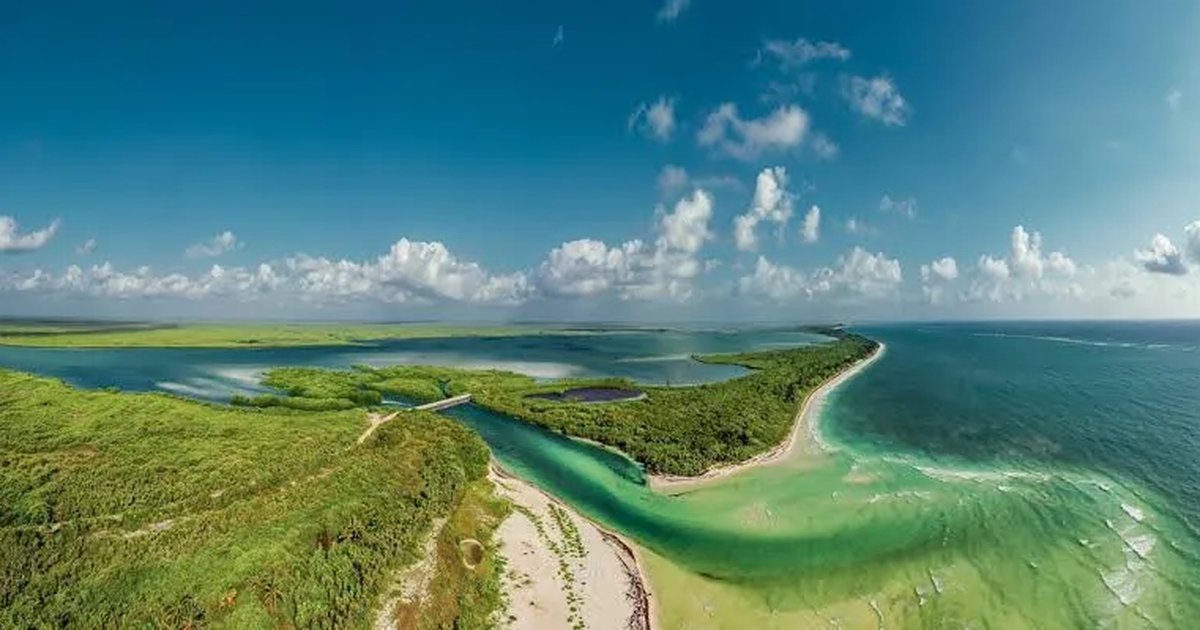
Sian Ka’an is a low-lying coastal biosphere reserve made up of lagoons, mangroves, marshes and beaches. A small rise in ocean levels therefore translates into broad flooding.
A study by the National Institute of Ecology and Climate Change (INECOL) and the National Autonomous University of Mexico (UNAM), released in 2025, ranks Sian Ka’an among the most flood-prone areas of the Gulf and the Caribbean under a one-meter sea-level rise. The risk extends beyond the beach to the entire wetland system that shields Tulum.
That study estimates roughly 581,000 hectares would flood across the Gulf and Mexican Caribbean with one additional meter of sea level, and up to 80% of coastal wetlands in low-lying areas would be affected.
How much will the sea rise by 2050 and 2100?
The IPCC projects a global rise of 0.15 to 0.29 meters by 2050. By 2100, the range widens sharply. Under a very low emissions scenario, the sea would rise 0.28 to 0.55 meters; under a very high emissions scenario, 0.63 to 1.01 meters.
That leaves about half a meter of difference by 2100 between mitigating emissions and not doing so. NASA and the IPCC stress that these are ranges by scenario, not a date on which a place is suddenly submerged. The sequence comes first as high-tide flooding, then as saltwater intrusion into freshwater supplies, and finally as gradual coastal erosion.
Wetlands are the first to suffer
The wetlands form Tulum’s first line of defense. They filter water, protect communities from storms and shelter the reserve’s plants and animals.
When the sea rises and saltwater reaches the lagoons, freshwater vegetation dies. Scientists documented mass vegetation loss from salinization in the Pantanos de Centla in Tabasco between 2018 and 2019. Damage in Sian Ka’an would therefore begin before the sea covers the reserve, and the loss of mangroves would leave Tulum more exposed to hurricanes and storm surge.
The precedent in Tabasco
The community of El Bosque, in Centla, Tabasco, has already lived through the process. Waves and erosion destroyed homes, the school and the church, and the community lost about 90 meters of coastline between October 2021 and April 2023.
In 2023, El Bosque became the first community in Mexico officially recognized as displaced by climate change. The government relocated families to Nuevo Bosque, about 12 kilometers inland, in November 2024.
Sian Ka’an is not a distant case, but the same pattern on a different coast, with a different ecosystem at stake.
What it means for Tulum
Tulum depends on its beach, its lagoon and its reserve. The town’s archaeological zone is already seeing a drop in visitors. The threat from the sea is different: not a one-year decline but mounting pressure decade after decade.
Meanwhile, the NASA tool lets anyone open the map, zoom in on Tulum and select a scenario and a decade to see the projection.
Sian Ka’an appears in the flooding projections because it is low, flat and dependent on its wetlands. The future is not written on a single date; it depends on how much the sea rises and how much the coastline is protected from now on.
More Environment
- Biologist Calls for Regulation of Chivita Snail Harvesting in Bacalar Lagoon
- IUCN Declares Mesoamerican Reef Critically Endangered
- UIMQROO Researcher Proposes Genetic Study of Dengue, Zika and Chikunguña to Aid Vaccine Research
- Playa del Carmen Keeps Macondo Playacar Permits on Hold After Judge Dismisses Environmentalists’ Injunction
- Cancún Operators Propose Sinking Abandoned Planes to Build Artificial Reef Park
More Tulum
- Tulum, Chacchoben and Cobá Lead Quintana Roo Archaeological Visits in 2025
- Quintana Roo Adds Five Hotels to the Michelin Keys 2026 Selection
- Tulum to Host First Quintana Roo Traditional Cooks Gathering
- Tulum Residents Launch Petition Demanding Transparency on Municipal Debt
- Quintana Roo Opens Files on Foreign Buyers’ Real Estate Fraud Claims