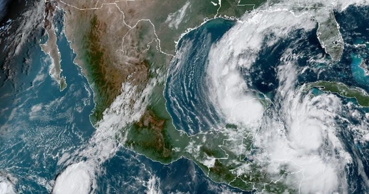
Cancún, Quintana Roo — The 2026 Atlantic hurricane season still has weeks to run, and officials say Quintana Roo should keep watching tropical systems across the Atlantic, the Caribbean and the Gulf of Mexico until the period closes on Nov. 30.
As of Oct. 3, the National Hurricane Center (NHC) had recorded eight named storms in the Atlantic: Arthur, Bertha, Cristobal, Dolly, Edouard, Fay, Gonzalo and Hanna. None of them reached hurricane strength. The NHC also reported no active tropical cyclones in the basin, though that could change in coming days.
When Does the 2026 Season End?
The official Atlantic tropical cyclone season began June 1, 2026, and will end Nov. 30. The period covers the North Atlantic, including the Caribbean Sea and the Gulf of Mexico, which keeps Quintana Roo inside the area that must track the evolution of tropical systems.
The Nov. 30 date is a climatological and operational boundary, not a guarantee that no cyclone can form afterward. NOAA notes that tropical systems can develop outside the official window.
Key Dates
- Start: June 1, 2026
- Climatological peak: around Sept. 10
- Historical period of greatest activity: roughly mid-August to mid-October
- Official close: Nov. 30, 2026
That means October, while late in the season, is still a month when Quintana Roo needs to follow weather advisories closely.
Which Storm Names Remain?
The World Meteorological Organization uses a preset list for the Atlantic, assigning names in alphabetical order as systems reach tropical storm strength. Six names remain on the 2026 list:
- Paulette
- Rene
- Sally
- Teddy
- Vicky
- Wilfred
Forecasters stress that having a name does not mean a system will become a hurricane. Names are given to tropical storms and cyclones that reach the intensity required for designation. If the season produces more than 21 named storms, the organization has approved a supplementary list.
A Below-Average Season So Far
NOAA updated its outlook in August and kept a below-normal scenario for the Atlantic, projecting seven to 13 named storms, of which two to six could become hurricanes and zero to two could reach major hurricane status. The ranges include systems already formed at the time of the update.
The agency said El Niño conditions could temper cyclone activity by increasing wind shear, a factor that makes it harder for tropical systems to form or intensify.
Even so, a quieter forecast does not remove the risk for Quintana Roo. A single system can cause significant damage if it approaches the Yucatan Peninsula.
Through Oct. 3, the eight named storms recorded by the NHC were below the 1991-2020 climatological average of 14, with zero hurricanes and zero major hurricanes to that point. Those figures describe the entire Atlantic basin and do not, on their own, determine the risk to Quintana Roo.
How to Read SMN Advisories
A storm’s name or category alone does not show the real risk. Advisories issued by the National Meteorological Service (SMN) include the system’s location, movement, intensity, forecast and possible effects.
- Location: where the center of the system sits and how far it is from Quintana Roo.
- Movement: the direction and speed of the cyclone. Tracks can shift, so each update should be checked.
- Maximum winds: the system’s intensity. A tropical storm becomes a hurricane once it reaches sustained winds of 119 km/h under the scale used for the Atlantic.
- Atmospheric pressure: the minimum central pressure, another measure specialists use to judge a system’s structure and strength.
- Watch or warning zone: the areas where wind or tropical storm effects could occur — especially important for coastal residents.
SMN advisories may also include forecasts for rain, wind, waves and possible waterspouts, even when a system is still far from Quintana Roo.
What the Alert Colors Mean
Mexico uses the Early Warning System for Tropical Cyclones (SIAT-CT) to communicate danger levels and the actions residents should take. The colors are read according to whether a cyclone is approaching or moving away.
During the approach phase:
- Blue: minimum danger / notice — the cyclone has been detected and is still a considerable distance from the area it could affect.
- Green: low danger / prevention — time to review family plans and stay alert.
- Yellow: moderate danger / preparation — residents should prepare for possible impact.
- Orange: high danger / alarm — preventive measures should intensify and civil protection instructions should be followed.
- Red: maximum danger / impact — the cyclone poses a major threat to the designated area and authorities’ instructions must be followed.
The meanings shift slightly during the moving-away phase: red indicates impact, orange alarm, yellow monitoring, green vigilance and blue notice.
What Coastal Residents Should Check
For people in Cancún, Playa del Carmen, Tulum, Cozumel, Isla Mujeres, Puerto Morelos, Mahahual, Chetumal and other coastal communities, officials advise against waiting for a system to be upgraded to a hurricane before preparing.
With each advisory, residents should check:
- Where the system is located
- Where it is heading
- How fast its winds are
- The forecast track
- Which municipalities fall inside watch or warning zones
- Expected rainfall and wave conditions
- The current SIAT-CT alert level set by civil protection authorities
It is also worth noting the time each advisory was issued, since forecasts can change as new data and observations arrive.
The 2026 season will officially end Nov. 30, but weather monitoring should continue as long as conditions favor the formation or development of tropical systems.
More Environment
- Cancun’s Tourism Reset: Regenerative Travel Takes Center Stage
- Quintana Roo Moves to Power Public Buildings With Clean Energy
- Mexican Navy Prepares 2027 Sargassum Strategy With 17 New Vessels
- New MARAP App Opens Anonymous Environmental Reporting in Playa del Carmen
- Judge Halts Trump Border Barrier in Big Bend National Park
More Quintana Roo
- Quintana Roo Schools Shut Oct 30 Creating a Four Day Weekend
- Quintana Roo Lawmakers Move to Curb Political Use of Social Programs
- Heavy Rains Flood Streets and Homes Across Quintana Roo, Cutting Power and Commerce
- INE Launches 2027 Elections in Quintana Roo Without Candidate Background Checks
- Quintana Roo Education and Training Chiefs Resign to Seek Morena’s Chetumal Nod