Yucatan Peninsula — The World Meteorological Organization (WMO) warns that while this year will be relatively quiet for tropical cyclones in the Atlantic and Caribbean region, it does not prevent the formation of major storms like last year’s Hurricane Melissa. The transition from La Niña to El Niño is expected to bring intense heat, wildfires, and drought to the Yucatan Peninsula and Caribbean.
The Atlantic waters will be warm, which will lead to torrential rains throughout the spring and summer alongside El Niño. The region faces conditions of intense heat, forest fires, and drought.
The Yucatan Peninsula is in a climate transition period after the departure of La Niña, which was characterized by irregular rainfall, historically low temperatures, and abnormal weather patterns known as the El Niño-Southern Oscillation (ENSO).
Starting in May, the El Niño phenomenon will bring elevated temperatures and droughts, but could also trigger more intense storms, water stress risks, and potential forest fires. The National Meteorological Service (SMN) is analyzing how these factors will influence the upcoming hurricane season.
CONAGUA meteorologists note that an early and strong appearance of El Niño will accelerate temperature increases in the Pacific Ocean waters. This phenomenon could severely impact Mexico and the region later this year, when droughts could become a serious problem threatening drinking water supplies for Mexicans.
During February, the characteristics of La Niña were very noticeable, with very cold nights alternating with hot days. This spring will see a progressive increase in ambient temperatures as remnants of La Niña/neutral phase persist, according to the Meteoros system.
The Imminent Arrival of El Niño
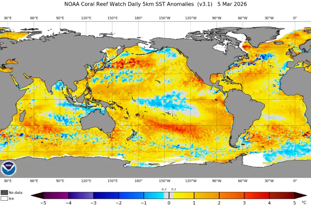
Joint data from CONAGUA and the National Oceanic and Atmospheric Administration (NOAA) indicate that as the summer season progresses, the effects of El Niño will become more pronounced.
Based on data from these institutions, there is a 50% to 60% probability that this scenario will occur, as Pacific waters are warming rapidly across an extensive region between the equator and the Tropic of Cancer that crosses Mexico.
While this phenomenon affects the Pacific coast more directly, its effects can reach the Peninsula and Caribbean, including elevated temperatures that will create sensations of extreme heat. Additionally, while days may be very hot and stifling, heavy rainfall could develop during afternoons or nights.
Due to the sharp temperature increase, plains and forests will experience drought in initial periods, causing greater heat sensations in urban centers since green spaces won’t function at normal capacity to naturally regulate temperatures.
Rainfall will be notable throughout the territory but could be so extreme that it causes flooding. The issue is that forest soils and vast natural areas, after suffering drought, will become so compacted that they won’t retain liquids as they normally would, creating flood risks.
Regarding temperatures, the SMN has forecast temperatures between 35°C and over 40°C for extensive regions of the country, including the Yucatan Peninsula. In contrast, for autumn 2026, temperature decreases are expected to be minimal since environmental conditions will have diminished the capacity for marked temperature drops as previously experienced.
It’s important to remember that, like all meteorological events, conditions for El Niño formation can change. So far, regarding hurricanes, the season is estimated to be “quiet,” but it’s known that these natural phenomena can change their conditions rapidly and extremely.
Discover more from Riviera Maya News & Events
Subscribe to get the latest posts sent to your email.