
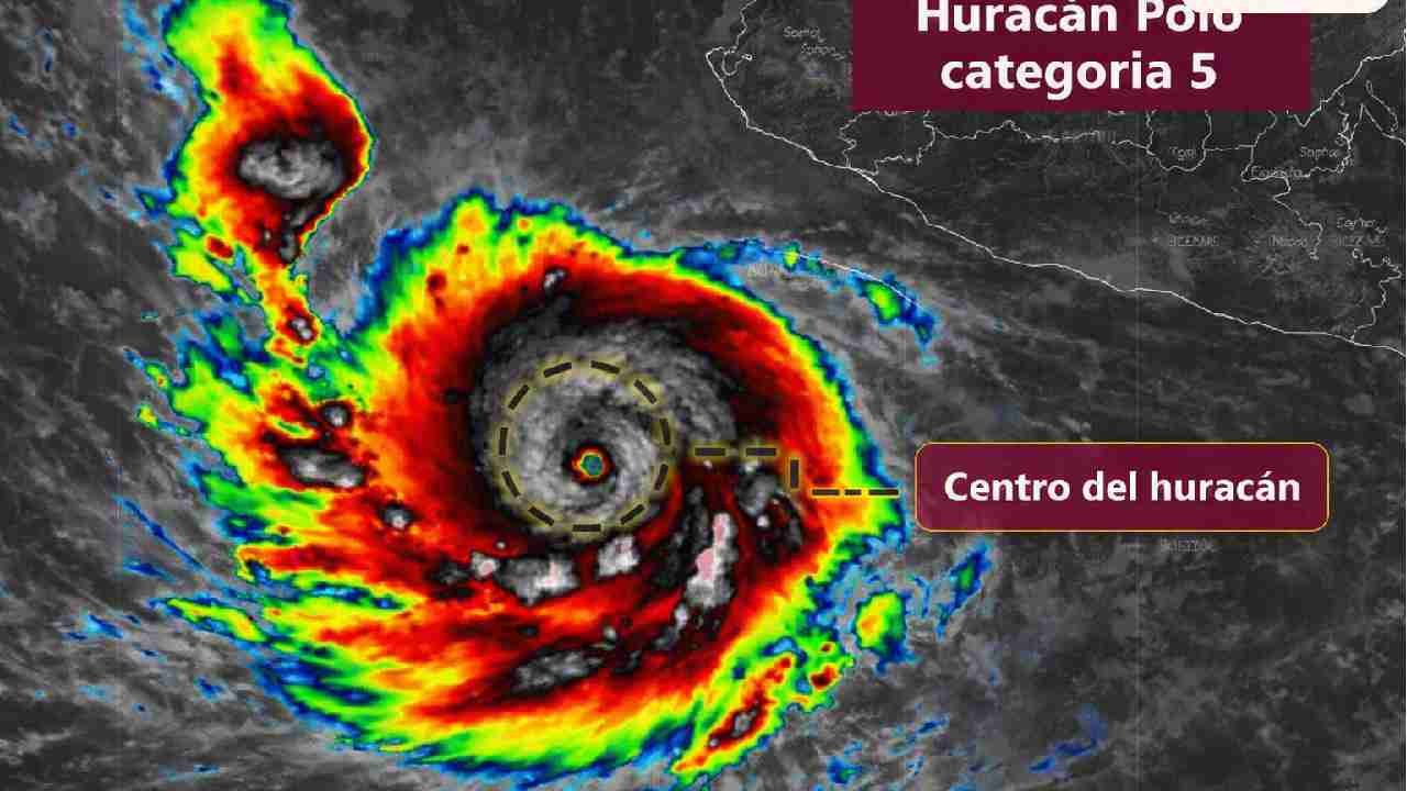
Mexico City — Hurricane Polo intensified to Category 5, the maximum on the Saffir-Simpson scale, over the Pacific Ocean, with sustained winds of 260 kilometers per hour (about 160 mph) and stronger gusts, Mexico’s National Meteorological Service (SMN) reported.
The storm’s center sits off southwestern Mexico and is moving slowly, a track that will keep it running parallel to the country’s coastline over the coming days. Forecasters expect it to turn toward the northwest starting Tuesday night.
Heavy Rain Forecast Along the Coast
The SMN forecasts rainfall of up to 150 millimeters (roughly 6 inches) in coastal areas of Guerrero, Colima, Oaxaca and Michoacán, with a high risk of landslides and flooding. Jalisco could see accumulations of up to 75 mm.
Guerrero, Colima, Oaxaca and Michoacán carry the strongest forecast for rain and powerful wind gusts, while Jalisco may also record significant precipitation.
Mexico’s water agency, CONAGUA, said intense rains were expected in Colima, Michoacán, Guerrero and Oaxaca.
Rapid Intensification
Weather monitoring account Backpirch Weather said Polo went through one of the most extreme rapid intensification phases ever recorded, with its winds rising by 110 mph and its pressure dropping 75 millibars in just 24 hours.
“Pacific Hurricane Polo has just been upgraded to CATEGORY 5 intensity after undergoing one of the most extreme rapid intensification phases ever recorded on planet Earth,” the account posted on X.
Officials Urge Caution
The SMN called on residents across the country to stay alert, consult official advisories and follow Civil Protection instructions, especially in coastal areas, flood-prone zones and regions at risk of landslides.
The storm is expected to bring adverse conditions to several states along the coast, mainly through heavy rain, strong winds and high waves. Authorities are monitoring the system for possible changes in its path.
More Environment
- Mexican Navy Opens Youth Photography Contest on Ocean Conservation
- WHO Warns El Niño Poses Major Global Health Threat
- Isla Mujeres Fishermen Face Grouper Shortage as Catch Barely Covers Local Demand
- Cancún Officials Urge Residents to Protect Pets After Reported Puma Sighting in Cuna Maya
- Playa del Carmen Beach Restoration Clears Environmental Hurdle, Mayor Says