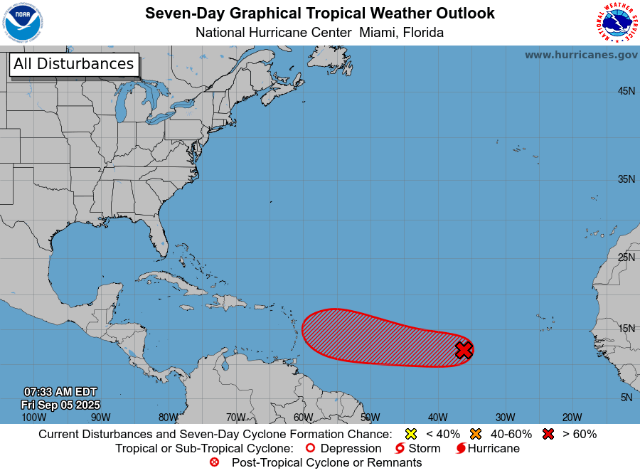
Riviera Maya, Quintana Roo – Sept. 5, 2025 — The National Hurricane Center (NHC) is monitoring a broad area of low pressure designated AL91 in the eastern tropical Atlantic. The system, tied to a tropical wave a few hundred miles west-southwest of the Cabo Verde Islands, is producing disorganized showers and thunderstorms, but the environment is favorable for gradual development.
Odds of formation: The NHC puts the chances at 60% within 48 hours and 90% within seven days, making a tropical depression likely this weekend or early next week.
Motion and timing: AL91 is moving westward at 5–10 mph and is likely to be near the Lesser Antilles by mid to late next week, according to the NHC’s morning outlook.
What it means for the Mexican Caribbean
The disturbance remains far out in the Atlantic and poses no immediate threat to Quintana Roo. Track and intensity forecasts beyond several days carry higher uncertainty, especially before a closed circulation forms. At this stage, the outlook simply signals that the system bears watching as it travels across the central Atlantic.
Seasonal context
Early September is the climatological peak of the Atlantic hurricane season, when “Cape Verde” systems commonly develop from African easterly waves. Warm sea-surface temperatures and generally favorable upper-level winds can help weak waves organize into tropical depressions or storms.
Practical preparedness notes
- Review basic storm supplies and check travel or marine plans later next week if you’ll be in the eastern Caribbean.
- Rely on official guidance from the National Hurricane Center and local civil protection agencies for updates and any advisories.
Source: National Hurricane Center “Tropical Weather Outlook,” 8:00 a.m. EDT, Fri., Sept. 5, 2025.
Discover more from Riviera Maya News & Events
Subscribe to get the latest posts sent to your email.