In recent weeks, four earthquakes have been recorded in Yucatán, which, according to experts, have been associated with the Ticul Fault, triggering these movements in the southern region of the state.
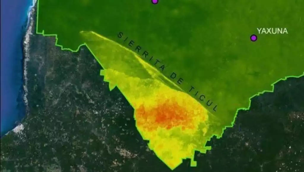
Yucatán Civil Protection reported that the recent earthquakes were associated with the so-called Ticul Fault, a scarp approximately 100 kilometers long with a west-northwest orientation.
Two relevant systems of normal geological faults are recognized in the Peninsula: the Ticul Fault and the Campeche–Hecelchakán Fault; due to their depth, frequency, and location, the recorded events can be linked to these structures.
What Is the Ticul Fault?
The Ticul Fault is an ancient geological fracture in the Yucatán Peninsula that, although inactive for centuries, has recently reactivated, releasing tension through low-magnitude earthquakes (such as one of 4.0 in December 2025), shallow (5 km), which are felt in the southern part of the state and are caused by internal adjustments of the Earth’s crust, not by imminent danger, but due to its karstic structure.
Earthquakes in Yucatán During 2025
So far in 2025, a total of five earthquakes have been confirmed in Yucatán, recorded in various municipalities, mainly in the southern zone.
According to the National Seismological Service, the first earthquake was recorded in the municipality of Ticul on October 10 with a magnitude of 3.8 degrees, ruling out damage.
It was not until December 5 when two more movements were reported within minutes of each other, as Civil Protection confirmed that they were two seismic events, one at 03:44 hours with a magnitude of 3.5 with an epicenter at Lat: 20.33° Long: -89.69° and a depth of 5 km.
The second was recorded at 3:46 hours with a magnitude of 3.7, with an epicenter at Lat: 20.33° Long: -89.69° and a depth of 5 km; both 17 km south of Muna.
The movement was recorded at 3:46 hours in the early morning of that Friday, and according to testimonies, it was felt as far as the municipality of Ticul.
Now, it was during the night of December 11 when a new tremor was recorded at 8:49 p.m. at a depth of 5 kilometers in Ticul, with a magnitude of 4.0 degrees, being the highest that has occurred so far this year.
Other Earthquakes in Yucatán
According to available instrumental records, in the period from 1900 to 2025 at least 84 earthquakes have been documented in the Yucatán Peninsula region (Campeche, Yucatán, and Quintana Roo). The highest magnitude on land was 4.6 degrees, recorded on June 10, 2002, 60 kilometers south of Felipe Carrillo Puerto, Quintana Roo.
Of these 84 events, 10 had their epicenter in Yucatecan territory, both on land and at sea; the highest magnitude was also 4.6, occurring on July 24, 1978, 417 kilometers north of Progreso, at a depth of 5 kilometers.
Discover more from Riviera Maya News & Events
Subscribe to get the latest posts sent to your email.