Mexico City — The El Niño climate phenomenon is projected to return in the summer of 2026, with a 62% probability of development, threatening unprecedented extreme weather, record temperatures, and droughts across Latin America, according to international climate monitoring bodies.
The transition to El Niño will officially begin between June and August 2026, following the conclusion of the La Niña phase in April. There is a 62% chance this warming will intensify toward the end of the year, drastically altering global temperatures and rainfall patterns.
End of La Niña and Onset of a Climate Truce
Current atmospheric conditions show the La Niña phenomenon has entered a definitive weakening phase. Temperature records in the equatorial Pacific indicate a trend toward normalization, marking the end of a prolonged cooling cycle. According to current projections, this transitional phase, known as ENSO-neutral, will establish itself in April.
Indicators suggest a 55% probability these neutral conditions—where neither extreme cold nor heat dominates the ocean—will remain stable during the May to July quarter. This period will act as a meteorological bridge before warming dynamics take control of the global thermostat.
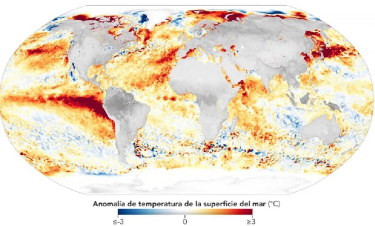
Return of Extreme Heat During Summer
Climate monitoring now focuses on a clear warning from international agencies: accumulated heat beneath the ocean surface is rising. This movement of warm water masses is the precursor to the El Niño phenomenon, whose arrival is estimated for the June to August 2026 window.
The possibility of this event developing and gaining intensity toward year-end is 62%. While it is still premature to determine its exact magnitude, advanced prediction models, such as the European ECMWF, already outline a concerning scenario. There is an estimated 22% probability the world will face a “Super El Niño,” an exceptionally intense variant that typically pushes global temperatures toward historical records and causes severe atmospheric disruptions.
Transformation of Rainfall and Storm Patterns
The establishment of El Niño during the second half of 2026 will trigger a reorganization of planetary pressure and humidity systems. This climatic shift has direct consequences for cyclone formation and rainfall distribution across different latitudes.
- Hurricane Behavior: The Atlantic and Caribbean are expected to see a reduction in storm frequency due to wind shear that impedes their development. In contrast, the Pacific Ocean typically shows much more aggressive and frequent activity under these thermal conditions.
- Alterations in the Southern Cone: In regions like Argentina and Uruguay, the trend leans toward a notable increase in rainfall, raising the risk of soil saturation and flooding in vulnerable areas.
- Drought in the Tropical Belt: Central America and northern South America face a critical risk of prolonged dry periods. This water shortage directly impacts food security by affecting crops and reduces the capacity of hydroelectric plants to generate energy.
Direct Repercussions in Mexico and the Region
The impact of this warm cycle will not be uniform, creating marked contrasts depending on geography. For northern Mexico and the southern United States, the influence of El Niño usually translates into considerably wetter winters with higher snow or rainfall loads, which could partially alleviate accumulated water stress in those areas.
However, the rest of the country and agricultural regions must prepare for an environment of persistent heat. 2026 is shaping up to be one of the hottest years on record, combining the effect of global warming with the energy released by the Pacific Ocean. This reality necessitates an immediate review of water management plans and planting strategies for the second half of the year, as the availability of water resources will be the determining factor for economic and environmental stability.
Discover more from Riviera Maya News & Events
Subscribe to get the latest posts sent to your email.